Home

Aeronautical charts

Official aeronautical charts over the map, offline too

Approach, departure, arrival and aerodrome charts appear in their real position over the map, with the aircraft on top. They come from each country's official sources and are updated every AIRAC cycle.

Who it is for

  • IFR and VFR pilots
  • Instructors who brief with the chart
  • Those who practice procedures in the simulator
Georeferenced approach chart over the map in the Alfaero app
Real app screen

Features

Tap a feature to see how it works, how to use it and the technical details.

01 / 04

Chart in its real position

IAC, SID, STAR and ADC over the map, with the aircraft on top.
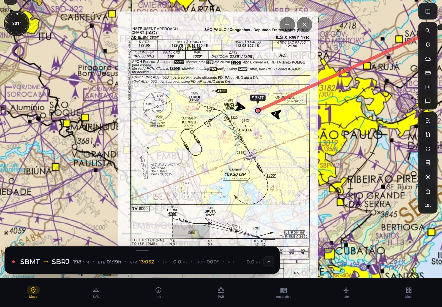
Georeferenced approach chart over the map in the Alfaero app
Real app screen

How it works

Each georeferenced chart has the coordinates of its boundaries. The app uses these coordinates to place the chart exactly where it belongs on the map, and your position appears on top of the procedure drawing.

How to use

  1. Open an aerodrome and choose the chart.
  2. Tap show on map.
  3. Fly following the aircraft over the procedure.

Technical details

Types on the map
IAC, SID, STAR and ADC
Georeferencing
Chart boundaries in coordinates
Brazil
1,873 georeferenced charts
US
9,987 approaches and 783 diagrams
02 / 04

Offline and on the AIRAC cycle

Download before you leave and get notified when a new cycle is published.

How it works

Charts are published by the authorities in 28 day AIRAC cycles. The app downloads the charts to the device, so they open without internet, and notifies you when a new cycle comes out so you can update before the flight.

How to use

  1. Download the charts for the flight's aerodromes while online.
  2. In flight, open them as usual: they are on the device.
  3. When the new cycle notice appears, update.

Technical details

Cycle
28 day AIRAC
Storage
On the device, without internet
Update
Notice on every new cycle
03 / 04

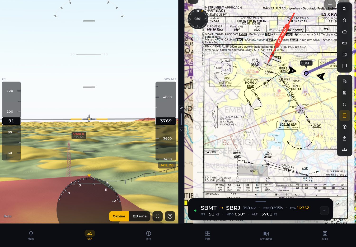
Split screen on the tablet

The chart on one side and the map or synthetic vision on the other.

Split screen on the tablet with the chart and 3D synthetic vision
Real app screen

How it works

On the tablet and on Windows, the screen splits in two: the original chart on one side, the map or 3D synthetic vision on the other. This way you read the procedure and see the terrain ahead at the same time.

How to use

  1. Open the chart on the tablet.
  2. Tap split screen.
  3. Choose map or synthetic vision for the other side.

Technical details

Where
Tablet and Windows
Combinations
Chart with map or with synthetic vision
04 / 04

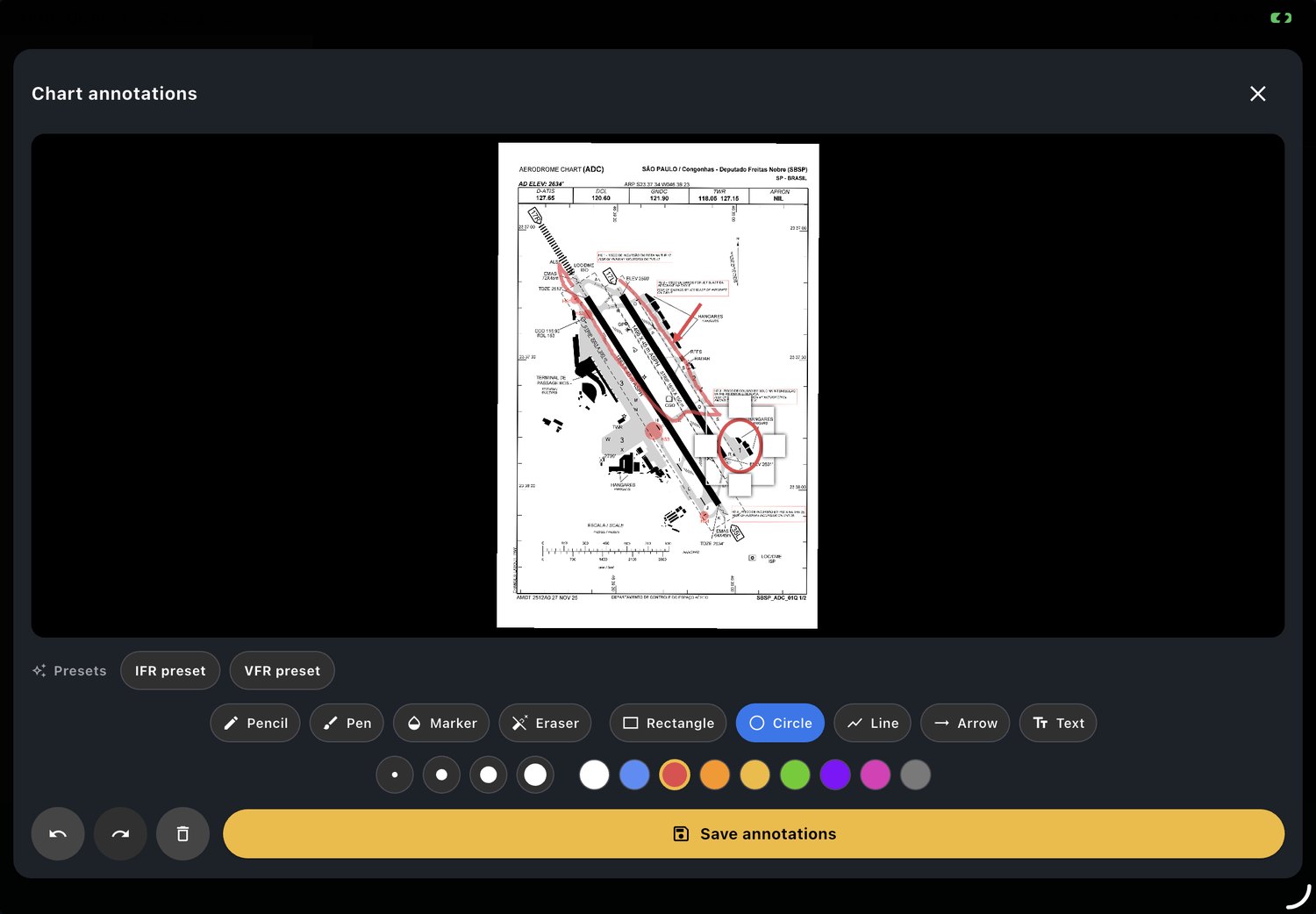
Chart annotations

Write and draw on the chart and pin what matters to the kneeboard.

Handwritten annotations on a chart in the Alfaero app
Real app screen

How it works

With your finger or a stylus, you write and draw on the chart, just as you would on paper. The charts you use most during the flight can be pinned to the kneeboard to open with one tap.

How to use

  1. Open the chart and tap the pencil.
  2. Write or draw on it.
  3. Pin the chart to the kneeboard for the flight.

Technical details

Input
Finger or stylus
Kneeboard
Charts pinned for the flight

Countries with charts in the app

Official charts from each country, georeferenced and updated every AIRAC cycle.

Frequently asked questions

Which countries does Alfaero have charts for?

Brazil, with DECEA charts, and the United States, with FAA charts.

Are the charts official?

Yes. They come from each country's official publications and are updated every AIRAC cycle.

Do the charts work offline?

Yes. Once downloaded, they stay on the device and open without internet.

What is a georeferenced chart?

It is a chart with its boundaries in geographic coordinates, which allows it to be placed over the map in its real position, with the aircraft on top.

Try it on your next flight

Download Alfaero on your phone, tablet or Windows PC and use everything during the trial period.