Home

Electronic Flight Bag

The EFB that follows your flight from planning to landing

Alfaero EFB brings the map, official charts, weather and aerodrome information together in a single app. In the cockpit, it shows your position from the device GPS, the terrain ahead in 3D and what the NOTAM changed at your destination aerodrome.

Who it is for

  • Private and commercial pilots
  • Flying club students and instructors
  • Those who practice procedures in the simulator
Live flight in the Alfaero app, with the aircraft over the map and the planned route
Real app screen

Features

Tap a feature to see how it works, how to use it and the technical details.

01 / 06

Live flight with GPS

Position, heading, speed and altitude on the map, with the track saved in the history.
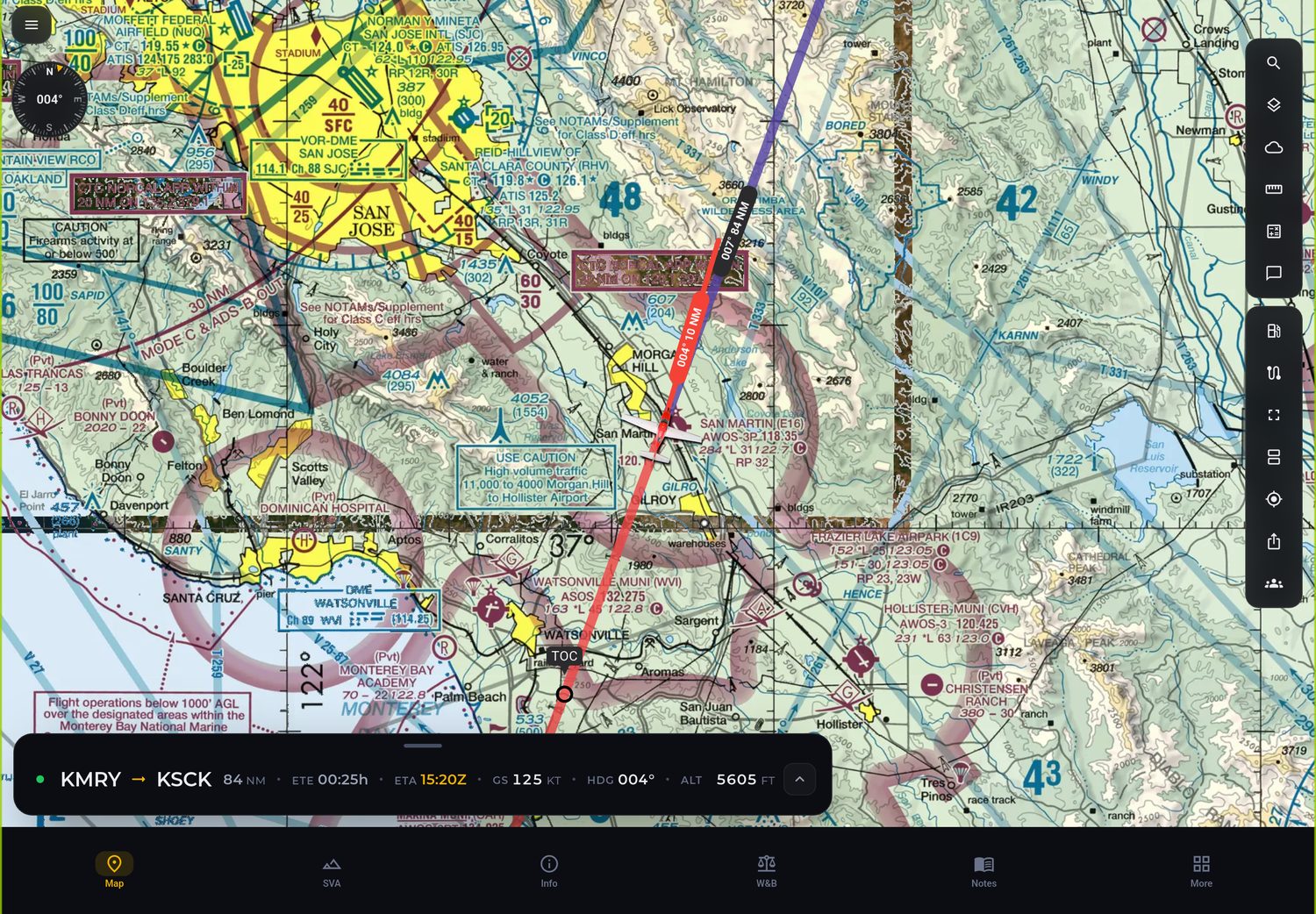
Live flight in the Alfaero app, with the aircraft over the map and the planned route
Real app screen

How it works

The app reads the GPS of your own phone or tablet and draws the aircraft over the map, the route and the charts. When you fly in the simulator, the position comes from the simulator instead of the GPS. Each flight is saved in the history with the track flown.

How to use

  1. Build or open the flight route.
  2. Allow location access when the app asks.
  3. Start the flight: the aircraft appears on the map over the route.
  4. At the end, the flight stays in the history with its track.

Technical details

Position source
Device GPS or simulator
Data on screen
Position, heading, speed and altitude
Logging
Track saved in the flight history
02 / 06

3D synthetic vision (SVA)

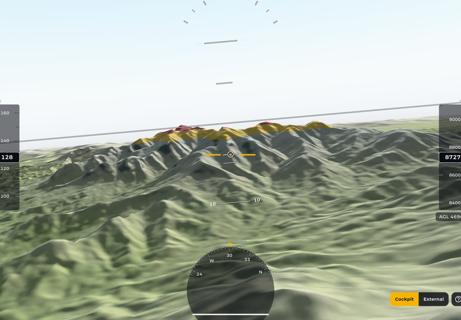
The terrain ahead in 3D, with yellow and red alerts based on your altitude.

3D synthetic vision in the Alfaero app with terrain colored by altitude
Real app screen

How it works

Synthetic vision builds the terrain ahead of the aircraft in three dimensions, from your position and altitude. Terrain close to your altitude turns yellow, terrain above it turns red. Wind turbines and power lines appear as obstacles.

How to use

  1. During the flight, open synthetic vision on the map.
  2. On the tablet, use split screen to see the chart on one side and the 3D view on the other.
  3. Watch the colors: yellow calls for attention, red is terrain above you.

Technical details

Alerts
Yellow and red based on altitude
Obstacles
Wind turbines and power lines
03 / 06

METAR and TAF explained

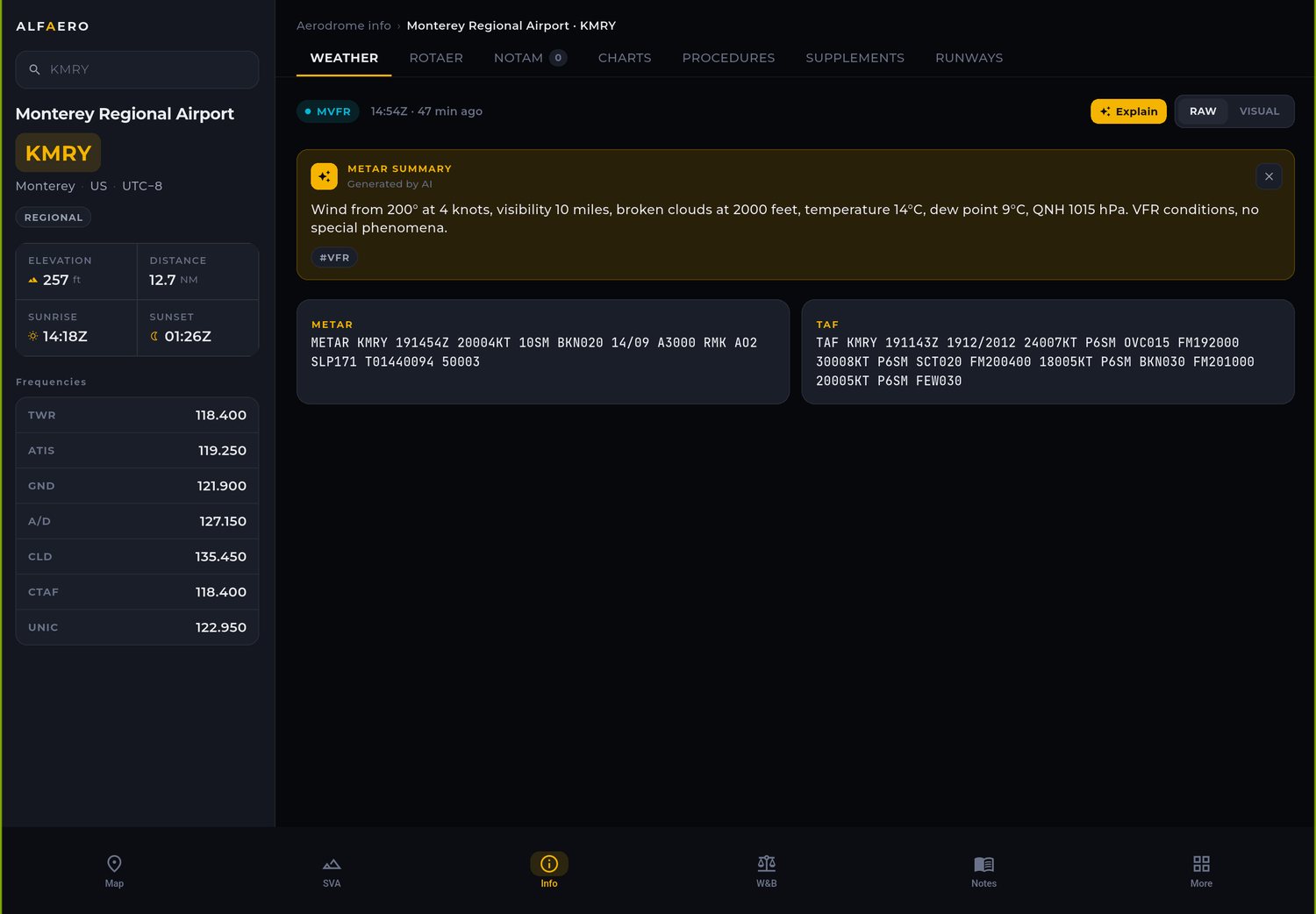
A plain language summary next to the original text, with NOTAM and frequencies.

Aerodrome page in the Alfaero app with METAR, TAF and the AI summary
Real app screen

How it works

When you open an aerodrome, the app shows the METAR (the current observation) and the TAF (the forecast) in the official format and, next to them, a summary written by artificial intelligence. The same screen holds the NOTAM, the ROTAER data and the frequencies.

How to use

  1. Tap an aerodrome on the map or search by ICAO code.
  2. Open the weather tab to see METAR, TAF and the summary.
  3. Check NOTAM and frequencies on the same page.

Technical details

Messages
METAR, TAF and NOTAM
Summary
Generated by AI, always next to the official text
Also on the page
ROTAER and frequencies
04 / 06

Wind for each runway

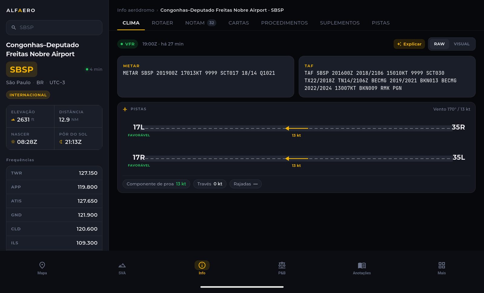
The METAR wind broken down into headwind and crosswind for each runway end.

Wind broken down by runway in the Alfaero app, with the favorable runway end marked
Real app screen

How it works

The app takes the wind direction and speed from the METAR and calculates the headwind and crosswind components for each runway end. The favorable runway is highlighted, which helps you anticipate the runway in use before calling the tower.

How to use

  1. Open the aerodrome and go to the weather tab.
  2. See each runway end with its wind components.
  3. Compare the crosswind with your aircraft's limit.

Technical details

Input
METAR wind
Output
Headwind and crosswind component for each runway end
Highlight
Favorable runway marked
05 / 06

Airport diagram and NOTAM

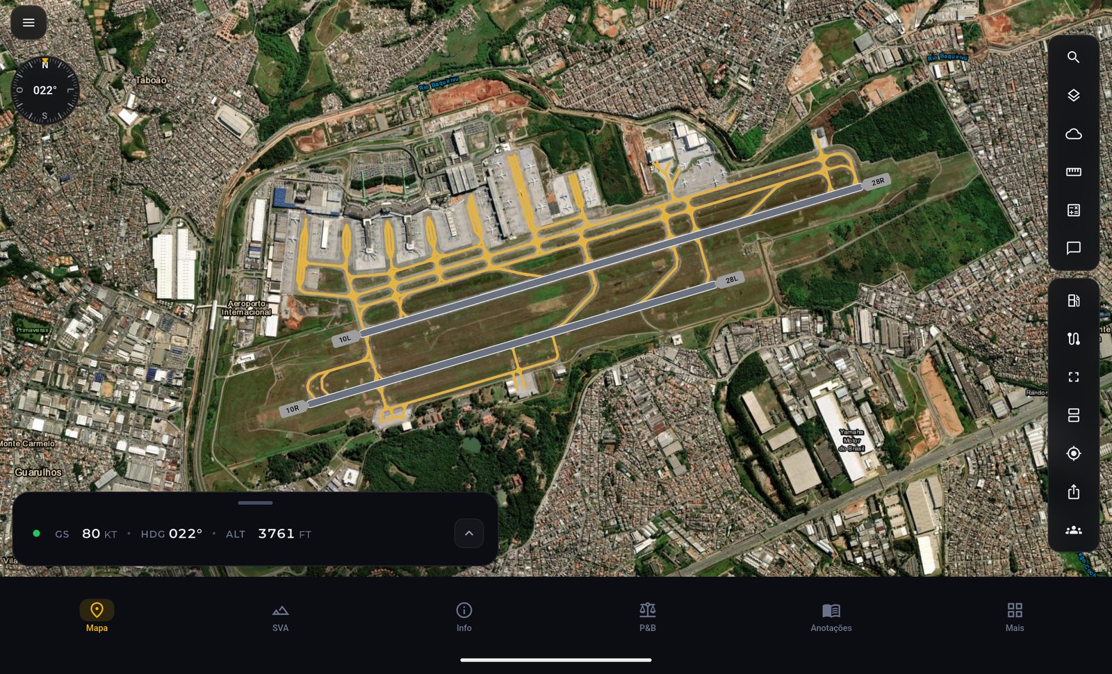
Runways, taxiways, aprons and gates, with whatever the NOTAM closes shown in red.

Guarulhos airport diagram in the Alfaero app over the satellite image
Real app screen

How it works

The diagram of Brazil's main aerodromes appears over the map with runways, named taxiways, aprons and gates. When a NOTAM closes a runway or taxiway, it turns red on the diagram itself.

How to use

  1. Zoom the map in on the aerodrome.
  2. See runways, taxiways, aprons and gates over the map.
  3. Check the NOTAM for what appears in red.

Technical details

Coverage
Brazil's main aerodromes
Elements
Runways, taxiways, aprons and gates
NOTAM
Closures in red
06 / 06

On all your devices

iPhone, Android, iPad, Android tablets, Windows, Apple Watch and Wear OS.

How it works

The same account works on every device: plan on the computer, fly with the tablet and check the essentials on your watch.

How to use

  1. Download the app from your device's store.
  2. Sign in with the same account on all of them.

Technical details

Phone
iPhone and Android
Tablet
iPad and Android tablets
Computer
Windows, through the Microsoft Store
Watch
Apple Watch and Wear OS

Frequently asked questions

Is Alfaero EFB for real flying or only for the simulator?

Both. The app was born for real flying, with official charts, the device GPS and official weather. In the simulator, it receives the position from Microsoft Flight Simulator, X-Plane or Aerofly FS and works the same way.

Does it work without internet?

Yes. Downloaded charts and the map stay on the device, and the position comes from the GPS, which does not depend on internet. Weather and NOTAM need a connection to update.

Which devices does it work on?

iPhone, Android, iPad, Android tablets, Windows computers, Apple Watch and Wear OS watches.

Does the app replace official documentation?

No. Alfaero is a tool that supports situational awareness. Official publications and the judgment of the pilot in command still apply.

Try it on your next flight

Download Alfaero on your phone, tablet or Windows PC and use everything during the trial period.